

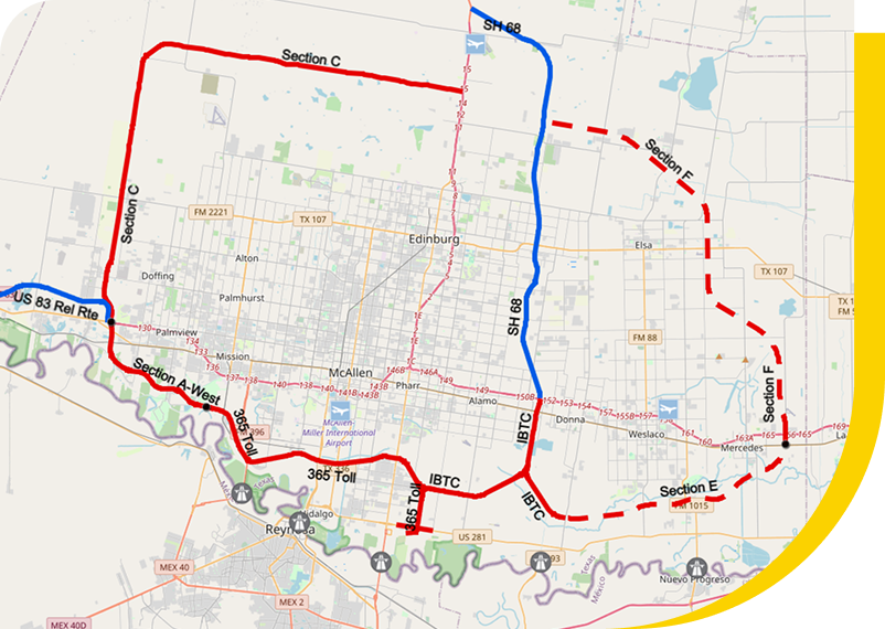
Geographic Information System
HCRMA’s Geographic Information System (GIS) map contains potential future roadway alignment maps, and overweight corridor routes related information. Content contained on these pages is intended for public use. Please Contact Us for access and technical support.
DISCLAIMER: Data displayed on this website is for informational purposes only and may not have been prepared for or be suitable for legal, engineering, or surveying purposes. It does not represent an on-the-ground survey and represents only the approximate relative location of roadway alignments and boundaries. No claims are made to the accuracy or completeness of the information shown herein nor to its suitability for a particular use. The scale and location of all mapped data are approximate.